MapScholar

Menu

Skip to content
  • Discover
  • Build
  • Featured Atlases
  • News
  • Contact
  • The History Database Project

Category Archives: Atlases

Post navigation

Newer posts →

Mapping the “Whole Coast”

Posted on September 26, 2014 by MapScholar

whole_coast_cover

Territory, Cartography, and the Problem of Scale in British America, 1763-1775


Posted in Atlases

Mapping Carolina

Posted on September 24, 2014 by MapScholar


mapping_carolina_coverCartography and the Quest for Empire in the Colonial Southeast

Posted in Atlases, Featured

Visualizing Early America

Posted on September 17, 2014 by MapScholar

VisualizingEA

 Three Maps that Reveal the New World

Posted in Atlases, Featured

Planting

Posted on September 17, 2014 by MapScholar

planting_cover
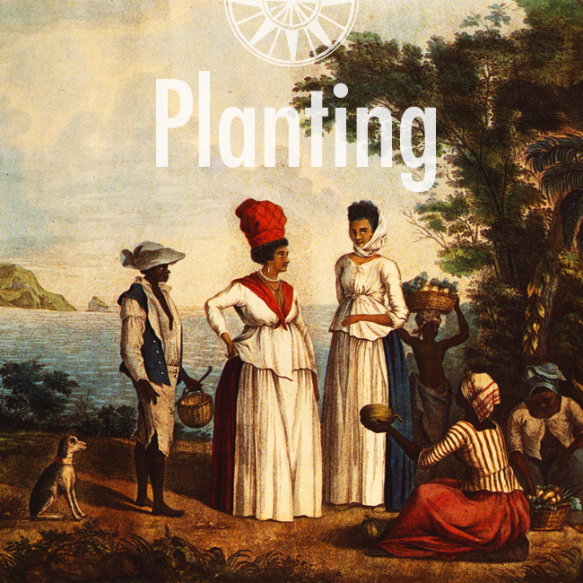
A Spatial History of British Colonization in the Ceded Islands, 1760-1776

Posted in Atlases

The Atlantic Neptune

Posted on September 17, 2014 by MapScholar

atlantic_neptune_cover

Posted in Atlases

Post navigation

Newer posts →

Featured Atlas

The Drawings of Zeev Porath

Search

News

  • Updated Florida Digital Atlas for The New Map of Empire released

    July 21, 2017 1:57 pm

  • Maps in World History

    May 4, 2017 2:28 pm

  • The Eighteenth Centuries

    May 3, 2017 9:23 pm

  • The Drawings of Zeev Porath

    April 9, 2017 12:51 pm

  • The Territorial Pattern of Settler Populations in North America

    December 7, 2015 9:37 pm

Archives

  • November 2017
  • August 2017
  • July 2017
  • May 2017
  • April 2017
  • December 2015
  • November 2015
  • December 2014
  • November 2014
  • September 2014
  • January 2014
  • April 2013
  • October 2012
  • August 2012
  • July 2012
  • January 2012
MapScholar is released under the MIT License. Site powered by WordPress, based on Bota theme by Ossie.